IRIS Focus for aviation

Scalable, modern remote sensing software for complete situational awareness at the airport and beyond.

    ANALYZE THE WEATHER FASTER

    Image
    Nowcasting


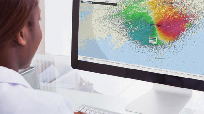
    Extreme weather is growing in frequency and intensity with climate change, making it more challenging and more important to understand and anticipate weather hazards. Air traffic controllers, meteorological observers and other airport decision makers need to make fast, well-informed decisions with the ability to quickly analyze detailed weather data and generate real-time weather alerts.

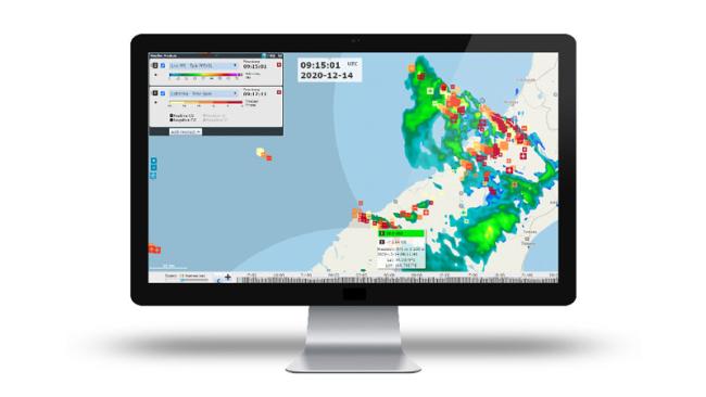
    With Vaisala IRIS Focus, you gain a superior understanding of storms, windshear and turbulence for safe and efficient takeoffs and landings. IRIS Focus combines data from remote sensors including weather radar, wind lidar, lightning precision networks and other data sources like satellites to provide an interactive visualization of weather data.

    The web-based interface includes storm tracking, nowcasting, and cross-section tools for a better understanding of storm movement and structure. Integrated decision support saves time with real-time monitoring, automated weather hazard detection, and customized alerts for a specified geographical area such as the airport, terminal maneuvering area, and beyond.


    DOWNLOAD BROCHURE

    TAKE YOUR INSIGHTS HIGHER

    Image
    WindShear


    IRIS Focus bring you more of the insights you need to make effective decisions at the airport.

    • Windshear detection and alerting along approach and takeoff paths based on weather radar and wind lidar data
    • Turbulence feature characterizes low-level turbulence using wind lidar data and assesses its severity — critical information for many airports in cities and close to complex topography like mountains
    • Characterization of many types of weather hazards and weather conditions thanks to the set of analysis tools and products available
    • Range Time Indicator shows time of rays and ranges of all datatypes (velocity, reflectivity) for radar and lidar scans, useful for investigating cloud/aerosol layers, boundary layers, convection, wind gusts.
    • Group Event allows you to define and prioritize several events to generate one alert message depending on the event state
    • Alert API allows remote users and systems to receive secure alert messages generated by IRIS Focus
    • Nowcasting feature indicates upcoming weather hazards and lightning storms up to 2 hours ahead
    • Fully-configurable weather events and alerts based on multiple criteria that can be applied on existing products for each remote sensor and notified to operational users through email, SMS and Alert API.


    DOWNLOAD BROCHURE

    INTEGRATION AND SECURITY

    Image
    Iris Focus for Aviation


    Save time with integrated decision support + secure access

    Use real-time situational displays to monitor weather conditions. Get customized alerts for specified geographical areas, plus near-real time automatic weather hazards. Notify multiple users of weather events through email, SMS, your mobile device and remote systems with the alert API.

    Easily share your data with other stakeholders, knowing your data is backed by high cyber security standards tested by industry experts. Web-based access with customizable views supports up to 500 simultaneous, definable users.

    DOWNLOAD BROCHURE

    ONE PLATFORM, MANY DATA SOURCES

    Image
    Iris Focus for Aviation


    Optimize with one platform for multiple data sources

    The comprehensive IRIS Focus software integrates data from various remote sensors and technology sources including weather radar, lightning data, wind lidar and external data such as satellites through the Web Map Service (WMS) feature.

    Multiple weather radars can be combined through composite to display the data of the whole network. Both weather radar and lightning data can be displayed at the same time. The many visualization and alerting features makes IRIS Focus ideal for aviation operations, and allows professional airport meteorological forecasters to optimize their workflows.

    DOWNLOAD BROCHURE

    Case Study: Improved aviation safety at Palermo Airport

    The Punta Raisi Palermo Airport in Italy meets its toughest windshear challenges with comprehensive Vaisala technology.

    LEARN MORE
    Vaisala IRIS remote sensing software for aviation

    Ready to get the most from your remote sensors?

    Vaisala’s aviation weather and runway management solutions are comprehensive, automated, and scalable to keep airport operations running smoothly no matter what the weather brings. Get in touch with us today and take your remote sensing observations to the highest level.

    Contact us