Improve your operational resilience with severe-weather monitoring and real-time lightning alerts
Losses from tropical cyclones and severe storms in the United States in 2022 cost almost $140 billion (USD), according to NOAA National Centers for Environmental Information (NCEI). Hurricane Ian alone caused losses of around $100 billion.
What’s more, both the number of extreme weather events and the financial cost of their impact have been rising steadily for the last 40 years because of climate change and other factors.
Tropical cyclones, severe storms, and lightning present a risk to people, property, and infrastructure. Operational resilience is a key priority for forward-thinking businesses and safety-critical industries.
Protect what matters most with Thunderstorm Manager
Thunderstorm Manager, part of our Xweather family of weather and environmental data services, delivers an all-in-one solution for real-time storm monitoring and automated lightning alerts.
Thunderstorm Manager v1.5, released today, introduces new weather layers for improved situational awareness and a secure alerting API for integrating lightning alerts into local displays, control centers, and other customer systems. Read on to learn more about the powerful new features in this update.
New weather layers for improved situational awareness
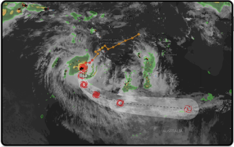
Tropical cyclones are the most damaging type of severe weather on a per-event basis. Businesses need to know when and how a tropical cyclone is going to impact their operations. The new tropical cyclone layer in Thunderstorm Manager provides an intuitive visualization that shows the severity category and projected path of cyclones, hurricanes, and typhoons.

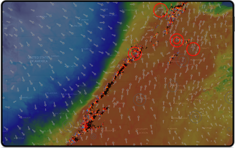
Weather is a complex, connected system. To better track and predict thunderstorm movements, it helps to visualize not only lightning strikes and radar but also other factors like wind and temperature. Today’s update adds new configurable map layers that improve your situational awareness of nearby storms:
- Global satellite infrared
- Temperature heatmap
- Temperature text labels
- Wind direction indicators
- Wind speed text labels
- Wind gust text labels
- Wind gust color scale

Severe weather monitoring and lightning alerts
When downtime costs thousands of dollars per minute, a fast and accurate assessment of severe weather risks is critical for maximizing operational efficiency while ensuring worker safety. But how do you decide when to halt operations and when to resume work?
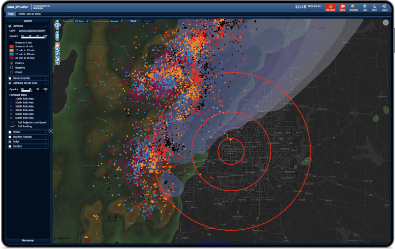
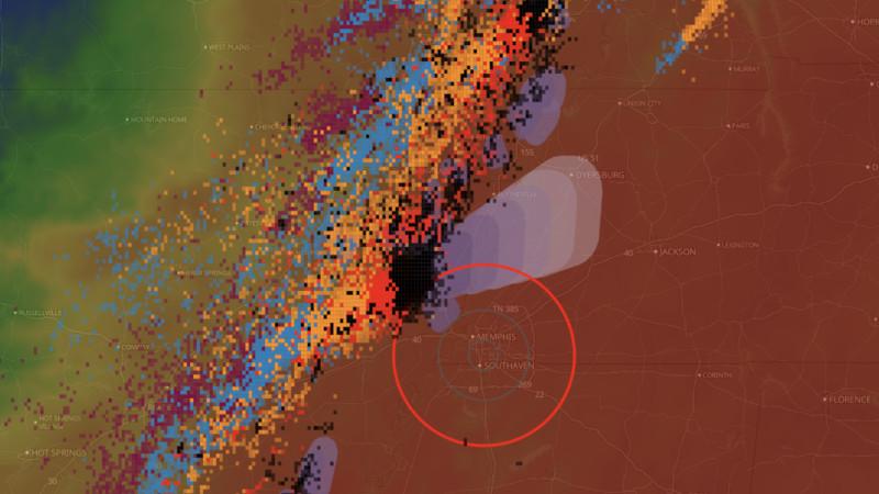
Thunderstorm Manager supports three levels of alerts (information, warning, and alarm), custom trigger distances, custom alert areas, and a choice of triggering criteria.
When a lightning flash is detected within the alert area, it triggers the alert and starts a countdown timer that resets if further strikes are detected in the area. When the timer gets to zero, Thunderstorm Manager sends an all-clear notification that it is safe to resume operations.

Secure integration with the new alerting API
You can send alerts and all-clear notifications to multiple email addresses, SMS phone numbers, and IoT warning systems, such as flashing lights, sirens, and on-screen displays.
Thunderstorm Manager v1.5 adds a new alerting API that sends a webhook-style API message whenever there is a change of state for a lightning alert ring. You can use the secure alerting API to integrate lightning alerts into your systems and safety protocols to get the right alert to the right people at the right time.
Quality you can count on
Vaisala Xweather detected more than 198 million lightning events across the continental United States and 99.9% of thunderstorms worldwide in 2022. With real-time delivery from strike to alert in 30 seconds or less and 99.99% availability, Xweather delivers accurate, reliable lightning data wherever and whenever you need it.
Powered by the unmatched detection efficiency and locational accuracy of Vaisala’s proprietary lightning detection networks, Vaisala Xweather is the primary source of lightning data for the U.S. Armed Forces, National Weather Service, Federal Aviation Administration, and many international commercial organizations.
Don’t leave lightning to chance
Start a free 30-day trial today and start protecting your people and operations with severe-weather monitoring and real-time lightning alerts for your site locations.

