WPD: Reducing uncertainty, reducing costs
Creating a strategic offshore wind resource assessment (WRA) campaign with scanning lidar
Germany-based wpd plans and operates wind projects both on- and offshore. The company has developed offshore wind projects since 2000 and is most active in Germany, Sweden, France, Finland, Taiwan, South Korea, and Japan. Asia is one of the largest offshore markets globally, and wpd is further expanding its offshore business in the region with support of lidar technology. In Taiwan, wpd has a strong onshore presence and, in 2018, was awarded the development of two offshore projects with a combined capacity of approximately 1GW.
Project details:
Location: Guanyin, Taiwan
Lidar: WindCube Scan 400S, onshore, 3-month campaign Met mast: Onshore, 17-month campaign
Lidar/met mast separation distance: 1.6km
The challenge: Confirm wind speeds with on-site measurements
For a WRA campaign in Guanyin, Taiwan, wpd needed to increase the certainty of wind data by simultaneously validating a 17-month onshore met mast campaign. To achieve this, a detailed pre-analysis of the offshore wind conditions (e.g., wind direction distribution, seasonality, etc.) was necessary to design a high-quality measurement strategy and demonstrate project bankability to consultants and possible investors.
The solution: Conduct a tailored, 3-month offshore-from-the-shore WRA campaign with long-range 3D scanning lidar
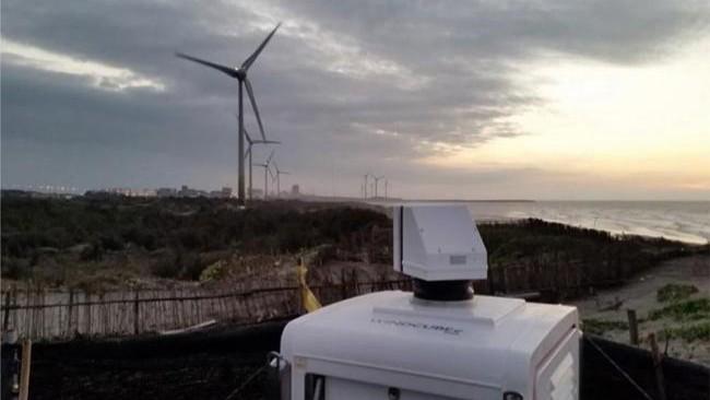
wpd knows measurement campaigns always must consider the site- and project-specific conditions. For this 3-month project at the Guanyin offshore wind farm in Taiwan, wpd relied on a WindCube® Scan 400S that was deployed in addition to an onshore met mast to ensure greater measurement heights and on-site wind data measurements. The choice came down to scanning lidar as the distance between the site and the shoreline was within the measurement range of the device, and it has also shown the best ratio between cost and measurement accuracy.
The benefits: Reduced uncertainty, discovery of simulation inaccuracy
Scanning lidars provide extensive advantages when assessing nearshore sites. Along with the expected wind profile data, the WindCube Scan lidar provided detailed information on land-to-sea speed-up effects around different points across the site. This helped the team identify higher wind speeds than those seen in simulations. The wpd team says one of the key benefits of using scanning lidar was modeling the wind field with a higher accuracy than would be possible with a vertical profiling lidar or met mast alone.
Most of all, WindCube Scan allowed wpd to achieve its goals of increasing the certainty of the wind data in accordance with the latest standards while keeping the campaign highly efficient and cost effective. "A carefully designed measurement concept can provide high quality results and keep required investment at a reasonable level," says Teresa Doll. The lidar proved to be the ideal tool for this, given Guanyin’s site-specific conditions (strong wind with high ambient humidity and presence of sand) and scanning lidar’s adaptability and reliability.
As wpd builds on its impressive track record for offshore development, WindCube Scan will remain a crucial tool in the company’s strategy for nearshore WRA and other applications.
