Low visibility — no problem
Lima International Airport expands confidently with a comprehensive AviMet RVR and AviMet AWOS solution

Located on the coast just north of Lima, Peru, Aeropuerto Internacional Jorge Chávez or Lima International Airport (LIM), is in its biggest ever growth phase. Peru’s main airport serves a significant amount of cargo transport in addition to more than 22 million passengers annually, and is expanding with a US $1.6 billion investment.
When fully operational in 2025, the expansion positions LIM to serve its growing passenger traffic of up to 37 million, with a new, modern terminal, second runway and new control tower, and is also the perfect opportunity to upgrade to the most modern Automated Weather Observing System (AWOS) available to support safe, efficient aircraft operations.
Challenging visibility conditions
LIM is categorized as a CAT III airport by ICAO due to Lima’s particular climate. It hardly ever rains or snows, but the El Niño current—which sweeps northward from the Antarctic region—creates a thermal inversion that leads to very low layers of dense clouds. These clouds significantly reduce visibility, sometimes to just a few meters, which is a major hazard for aircraft takeoffs and landings.
To address visibility challenges, LIM had been using a highly accurate Instrument Landing System (ILS), which requires specific training for pilots and crew to use properly. CORPAC (civil aviation and air navigation service provider of Peru) decided to upgrade and expand the airport’s AWOS and ILS systems during the expansion to fully support aircraft operations in any weather conditions.
Insights for building on success
CORPAC has worked with local Vaisala partner Morcom for many years, who supported the installation of a Vaisala AviMet AWOS at the airport more than a decade ago. The AviMet AWOS still provided the comprehensive and reliable real-time weather data LIM needed at the original runway, so Morcom worked with CORPAC to evaluate the current technology and recommend the best possible upgrades.
Trusted aviation weather from cloud to ground
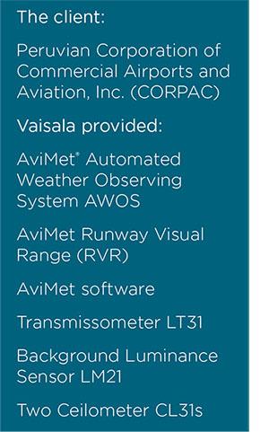
Morcom has worked on many Vaisala aviation solutions including AviMet AWOS, weather radars, lightning systems and even a tsunami warning system. With their in-depth experience, Morcom recommended a new AviMet AWOS along with a complete Vaisala AviMet Runway Visual Range (RVR) system for both runways to provide precise and timely information for pilots and control tower staff. Without the RVR insights in particular, aircraft would be unable to land and diverted to another airport during low-visibility conditions.
The solution for safe operations in low visibility
The comprehensive solution for LIM includes everything the airport needs to support critical operational decisions. AviMet AWOS, the foundation of weather awareness, includes all the standard measurement equipment: Weather, humidity, wind speed and wind direction, temperature and more. Fully compliant with ICAO and WMO requirements up to CAT III, AviMet AWOS is trusted throughout the aviation industry for high performance, ease of use and reduced operative costs.
Serving as the core of the airport’s RVR system is the Vaisala Transmissometer LT31 which is the world’s best, most accurate, and most frequently used visibility measurement instrument for runway visual range with cutting-edge visibility technology. Rounding out the RVR solution are Vaisala Background Luminance Sensor LM21s, fully-featured ambient light sensors.
Two Vaisala Ceilometer CL31s provide reliable cloud and vertical visibility measurements around the clock, while Vaisala Forward Scatter sensors accurately detect every form and amount of precipitation.
Always ready for safe takeoffs and landings
Jorge Chávez International is ready to serve its growing traffic with a comprehensive, interconnected weather awareness solution that enables safe takeoffs and landings no matter what El Niño brings. As part of the AviMet RVR system, the Transmissometer LT31 is independent of the type of visibility reducing particles present — ensuring the best accuracy in the most crucial low-visibility situations, and in all conditions.
It also automates many critical functions to provide unmatched accuracy, outstanding uptime and minimal maintenance. The combined AviMet AWOS, AviMet integration software and AviMet RVR system gives the airport a complete picture of current conditions so pilots know exactly what to expect and can fly safely and confidently.
"The airport expansion project is a significant undertaking and a collaborative effort between us, Lima Airport Partners and the Peruvian State government. The new runway will be fully operational in 2023, and it is very exciting to know we have a state-of- the-art RVR system available to support safe operations of the most important airport in Peru."
Manuel Ojeda, Director, Morcom International
