Webinar Q&A: Lidar innovation — How the wind energy industry is making waves offshore
In September 2023, we hosted a fantastic webinar with three wind energy industry giants to talk about how industry experts are using lidar right now. Benjamin Ahrens of Deutsche WindGuard, Robert Menke of DNV, and Felix Kelberlau of Fugro lent their expertise and insights on the state of lidar in wind energy. Here are the key questions and answers from that session.
Dual Scanning Lidar
Dual Scanning Lidar bankability & acceptance
Question: Has the dual scanning lidar measurement campaign been recognized as bankable?
DNV answers: Yes, to our knowledge there have been projects in the APAC region that have been financed based on scanning lidar measurements.
Vaisala answers: Yes, several commercial projects in Japan have achieved ClassNK certification. One of the major acceptance milestones in Japan was publication of the NEDO Offshore Guidebook that recognizes Dual Scanning Lidar as a bankable measurement solution for offshore Wind Resource Assessment (WRA).
Question: Will it be possible to validate the scanning lidars against alternatives to cups, either currently or as an option in the Guidelines?
DNV answers: We do not restrict the verification to cups. Any reference can be accepted. However, we only present uncertainty calculation for a lidar vs cup verifications in the guidelines.
Question: For which maximum distances of offshore sites scanning lidars located onshore might be used with reasonable uncertainty?
DNV answers: As a rule of thumb, scanning lidars can be used for WRA measurements of offshore sites that are 15 - 20 km from the shoreline. Please note that the measurement location will usually be 4 to 7 km from the shoreline, and may therefore lie near the edge of the offshore site.
Question: You mentioned that Dual Scanning Lidar can reduce the uncertainty in WRA, but does this already consider its low data availability compared to Floating Lidar Systems (FLS)?
DNV answers: Scanning lidar (SL) reaches similar data availability as FLS depending on the measurement distance and the atmospheric conditions at the site. Additionally, SL has the potential to measure at several planned turbine locations to reduce spatial uncertainty. Which measurement strategy (SL or FLS) will lead to the lowest uncertainty should be evaluated for each project.
Scanning lidar technology and applications
Question: Can the lidar estimate dissipation or just velocity vectors? What is the resolution, is it a function of range?
Vaisala answers: There are several studies that use scanning lidars to estimate the dissipation. For example, "Determination of eddy dissipation rate by Doppler lidar in Reykjavik, Iceland" (Yang et al., 2020) is one that uses a WindCube® Scan. The range resolution is configurable and ranges from 25 to 200m. It is independent of range for pulsed lidar systems.
Question: At which heights is the wind measured offshore from two lidars onshore? I assume vertical profiler reaches bigger heights and scanning lidar beam goes further offshore with limited height?
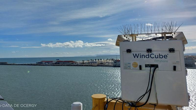
Vaisala answers: WindCube Offshore vertical profiling lidar measurement from 40m – 300 m at 20 simultaneous heights (range gates). The limitation of WindCube Scan is on the elevation angle (~5° is sometimes given as the recommended limit) so the maximum range depends on model. Higher than that is possible if you are willing to risk a higher sensitivity to vertical wind speed, which may not matter in 10 min statistics over the sea or in simple terrain.
Question: Has there been any scanning lidar used at offshore platforms or offshore substations?
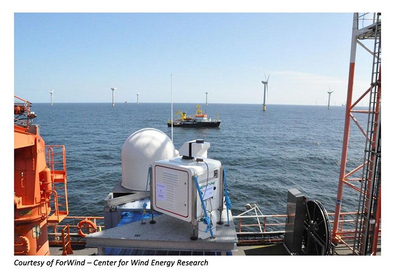
Vaisala answers: Scanning lidars have been used for various types of applications and in various installation conditions: onshore, offshore, on offshore platforms, ships, turbine transition pieces. Here is a project example where WindCube Scan was installed on an offshore platform: GW Wakes - RAVE: Research at alpha ventus (rave-offshore.de)

Data availability
Question: Up to which distance does the scanning lidar have an acceptable data availability?
Vaisala answers: The range at which a suitable data availability can be achieved depends on the model of scanning lidar, the configuration of the scan and the atmospheric conditions. In a Dual Scanning Lidar setup using two WindCube Scan 400S models, the acceptable level of data availability can be achieved up to the typical maximum operational range of the WindCube Scan 400S, which is 10 km. In certain atmospheric conditions (site dependent), this range can be further increased.
Turbulence Intensity (TI)
Question: What about Turbulence Intensity? Are there any validations?
Vaisala answers: Dual Scanning Lidar has been used to accurately measure TI. The accuracy of DSL has been demonstrated in various projects, including some result where DSL was compared to a met mast. Here are some of the validation papers:
- Shimada et al., 2022. Validation of near-shore wind measurements using a dual scanning light detection and ranging system
- Watanabe et al., 2021. A study of offshore wind assessment using dual-Doppler scanning lidars
- Young et al., WESC 2023. Verification of dual scanning lidar for wind resource assessment: assessing turbulence, long range and multiple height scanning
- Menke et al., 2023. Turbulence estimation by dual-Doppler scanning lidars
Vertical profiling lidar for offshore applications
Technology and applications
Question: What does 'Insensitive to high cloud layers' mean? Does it imply that the sensor has minimal impact due to clouds?
Fugro answers: The WindCube is a wind lidar using pulsed laser technology. With this technology, lidar sensitivity is limited to a defined vertical range, called the range gate. Cloud layers above the range gate do not influence the resulting wind data. This is different for typical continuous wave lidar, for which the impact of cloud layers has to be filtered in some cases.
Question: What is the key difference between using the continuous beam and pulsed lidar in floating lidar applications, regarding the accuracy of measurements and data availability?
Fugro answers: Both lidar types are equally well suited for floating lidar applications. At high elevations (>200m), WindCube measurement accuracy might be higher. Conclusive statements would require a direct comparison of both systems simultaneously at several sites against trusted reference sources (offshore met masts are not high enough).
Effect of motion
Question: Considering the shift of wind farms towards floating platforms, have we considered the impact of motion on the near-bottom layer (NBL)? Or is the sensor suitable for motion?
Fugro answers: The impact of buoy motion on mean wind speed measurements is negligibly small, when the measurements are corrected for buoy heading. For turbulence estimates, more advanced motion compensation has to be applied.
Question: Is any correction being applied to the wave effects on all the lidar measurement or is it just for the buoy movement?
Fugro answers: Buoy movement is the effect of ocean waves, so any correction applied will tackle both wave effects and buoy movement at the same time. The impact of buoy motion on mean wind speed measurements is negligibly small, when the measurements are corrected for buoy heading.
Data availability
Question: What data availability is reached offshore during the one year measurements? Under which weather conditions wind can't be measured (availability drops down)? Is it higher or lower than onshore?
Vaisala answers: Data availability in the offshore environment is generally high, as there is always a good level of aerosol presence in the salty, marine conditions. That said, lidar data availability can vary from site to site, but all floating lidars (depending on their stage of maturity) have to achieve specific KPIs defined by Carbon Trust OWA. More information here.
Fugro answers: Please see the table for an overview of system and data availabilities throughout the six-months-long sea trial. In general, we see very high data availabilities from our SEAWATCH Wind Lidar buoys and assume that the humid salty air offshore offers better conditions for wind lidar measurements than most onshore conditions.

Question: I noticed that onshore lidar has more data loss than met mast. Is this also the case for lidar offshore measurement? If so, what are the main causes for data loss and do you think that it may impact the data analysis such as WRA?
DNV answers: Lidar availability can be reduced by a number of atmospheric conditions such as fog, rain, clear sky, or clouds. This is the same on- and offshore and will vary strongly depending on local climate at the measurement site. As long as the campaign availability is within the IEC stated limits, the impact on resource assessment should be small.
Vaisala answers: Loss of power supply can lead to the lack of measurement data. If it is only a communication issue, data will remain in the WindCube and can be sent when communication is established once again. To better understand the pulsed lidar data availability as well as to learn more about Vaisala’s recommendations and tools on how to boost data availability, we invite you to read this scientific poster written by our Research & Application Engineer, Andrew Black.
More information
Watch the full panel discussion: Lidar innovation: How the wind energy industry is making waves offshore here.
