Measuring Turbulence Intensity with wind lidar
Your webinar questions answered
Our recent Innovations Webinar: Measuring Turbulence Intensity with wind lidar was very engaging and spurred a lot of interesting discussions. Read on for some of the audience questions posted during the webinar, with answers provided by experts from Vaisala and France Energies Marines.
Turbulence Intensity measurements by lidar: Acceptance trends
Question: The standard for load measurement IEC 61400-13 defines Turbulence Intensity (TI) as “…if measured through a hub height anemometer (sonic or cup). If other wind speed sensing techniques are used, the derived TI shall be equivalent to that measured by either a sonic or cup anemometer." Can Vaisala provethe mentioned "shall", which means a must in standard language?
Vaisala answers: Indeed, the IEC -13 refers to the TI measurements with cup anemometer. Lidars measure wind speed differently compared to the traditional cup anemometers, so perhaps this should be well documented in the standard to increase lidar acceptance for TI measurements.
When it comes to WindCube® Nacelle lidar, we consider the slope, offset and correlation coefficient in the TI comparison between WindCube Nacelle and met mast. These parameters show that the TI measured by WindCube Nacelle efficiently represents the wind flow turbulence status, so the TI measured by nacelle-mounted lidars could be applied to the IEC 61400-13.
Question: How does the P90 of TI compare between the met mast and the lidar (as per IEC for classification)?
Vaisala answers: We don’t compare the P90 of TI currently, but the results achieved with the new algorithm reduce the uncertainty of the TI measurement. Because the TI is calculated using 1 Hz wind speed data, this result proves the wind speed measurement by WindCube Nacelle is accurate.
In general, we compare all TI data with met mast and the results are generally good with high correlation between lidar and met mast, so P90 of TI from lidar and from met mast should be pretty close.
Question: Will we ever see this technology completely replace on-site met masts for TI?
Vaisala answers: Wind lidars are at a good trend to eventually replace met masts for wind measurements. This is already the case offshore, where the TI topic and the impact of motion on measurement is included in the IEC 61400-50-4 (use of floating lidars for wind measurement). A similar trend can be expected for onshore measurements.
Today, there are several industry efforts to increase acceptance of lidar-measured TI (e.g., DNV-JIP and CFARS). If we can correct lidar TI measurements and demonstrate good agreement with cup TI, this will allow for complete wind energy development with “standalone” lidar: both Energy Yield Assessment (EYA) and Site Suitability analysis.

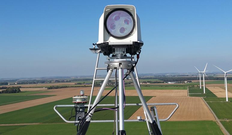
TI algorithm for WindCube Nacelle
Question: Was the USA project carried out in simple or complex terrain (based on IEC 61400-50-3)?
Vaisala answers: This pilot project presented in the webinar was carried out in flat terrain.
Question: Considering the test in USA was carried out in simple terrain, do you have any estimation of this accuracy in complex terrain?
Vaisala answers: We are currently working on preparing a pilot project in complex terrain and will share the results in the future.
Question: How far from the nacelle lidar you would consider accurate the TI measurement?
Vaisala answers: We have mainly tested the algorithm at 2.5D (as per IEC standard for PPT measurements) and at different sites. The obtained results are good. We can assume the same accuracy for other distances, but further investigation is needed as the vertical distance of upper/lower beams is not the same at different distances.
Question: How to you translate LOS TI to X, Y, Z TI to streamline TI?
Vaisala answers: For WindCube Nacelle, we need to assume the wind flow is along the center line of a wind turbine, so TI(WindSpeed)= SD/WS=SD*cos(a)/(WS*cos(a))=SD(RWS)/RWS=LOS TI.
Question: Are you aware of any third parties who have performed the same comparison and obtained the same results?
Vaisala answers: The TI algorithm has recently been introduced with WindCube Nacelle, so there are a limited number of measurement campaigns performed by third parties using this new algorithm.
Question: Are these conclusions also valid for ground-based lidars? Which effects do you expect if the dimension of the radial wind is much lower?
Vaisala answers: We think the result of TI comparison at Line of Sight (LOS) is valid for ground-based lidar. One difference is that the nacelle lidar measures horizontally. The TI comparison is carried out at a low height of 30 m.
Question: How does the standard deviation of Turbulence Intensity agree with the met mast? (Often for lidar/sodar we can see reasonable agreement on the mean TI, but the standard deviation of TI does not agree.
Vaisala answers: Currently, for WindCube Nacelle, we compare the Standard Deviation (SD) of TI in the bin of wind speed. SD of TI between met mast and WindCube Nacelle agrees well.
Question: If the prototype lidar results are successful, will you implement the changes on WindCube V2.1?
Vaisala answers: The algorithm presented in the webinar has already been integrated with WindCube Nacelle lidar. WindCube ground-based lidar doesn’t have the same outliers as nacelle-mounted lidar, so further investigation would be needed.
Question: Can we use the same logic (i.e. the new TI algorithm for WindCube Nacelle) be used for ground-based vertical profiling lidars?
Vaisala answers: The general principle of relative wind speed (RWS) for WindCube and WindCube Nacelle is very similar: We can potentially apply the same algorithm on the ground-based lidar, but Vaisala has not yet tested this. For the vertical profiling lidar, there are other aspects to take into consideration.
France Energies Marines project: Deriving TI from pulsed lidar profilers
Question: What do you think affects the TI value from floating lidar more: volumetric effect or lidar motion?
FEM answers: It depends on the method used, i.e., standard or variance, the altitude of measurement (inter-beam volume averaging has a higher impact at higher altitude because the area in which turbulence metrics are being integrated increases with altitude), and the sea-states. Volume-averaging leads to under-estimation of TI, while the buoy-motion induces over-estimation of TI. It is possible that, sometimes, one could get the right TI in comparison to a reference measurement, but for the wrong reason. Both sources of error would compensate each other. We need to perform a numerical study with a virtual lidar to answer your question properly.
See these documents for more information:
- Sathe, A., Mann, J., Gottschall, J., & Courtney, M. S. (2011). Can wind lidars measure turbulence? Journal of Atmospheric and Oceanic Technology, 28(7), 853-868
- Kelberlau, F., & Mann, J. (2020). Cross-contamination effect on turbulence spectra from Doppler beam swinging wind lidar. Wind Energy Science, 5(2), 519-541

Question: Is there any limitation on the pitch and roll from the floating lidar that requires a measurement cutoff? How do you plan to correct the pitch and roll of the lidar?
FEM answers: Not sure the question is fully understood. For the first point, no, there is no limitation in pitch and roll under which the measurement is considered invalid, and a cutoff is required. This was not the aim of this experimentation.
Usually, "geometrical" correction is applied to take into account the tilt of the lidar, however this is not considered in this work. The goal was to quantify the impact of the motion of the high frequency radial measurement and to remove the variability induced by the motion from the variability induced by turbulence.
Question: The overestimate or underestimate of standard and variance methods stays always the same regardless of the site conditions? If variance method is used, can we assume the TI is "always" underestimated?
FEM answers: The overestimation/underestimation depends on the atmospheric stability which governed the size of the eddies (and integral length-scale). This is site specific. If one pair of lidar beams is aligned with the wind direction, we can apply the method with the hypothesis that u'v' is negligible. The source of error of the variance method is the probe-volume averaging. Preliminary results of POWSEIDOM show that, in this condition, the variance method will lead to systematic underestimation of TI since the eddies of length scales lower than the probe length are filtered out.
Question: You mentioned "cross-contamination" error, but don't you agree you could use three lidars to eliminate cross-contamination by using three converging beams?
FEM answers: To eliminate the cross-contamination, one can deploy two scanning lidars and employ them in dual-Doppler mode, i.e., a setup of two long-range scanning lidar whose beams meet in one point.
Want to learn more about recent developments in measuring Turbulence Intensity with wind lidar? Take a look at these resources:
- Blog: WindCube Nacelle TI algorithm
- eBook: New advancements in measuring Turbulence Intensity with wind lidar | Vaisala