Micro Weather Service: New tool shows big results for navigating around thunderstorms
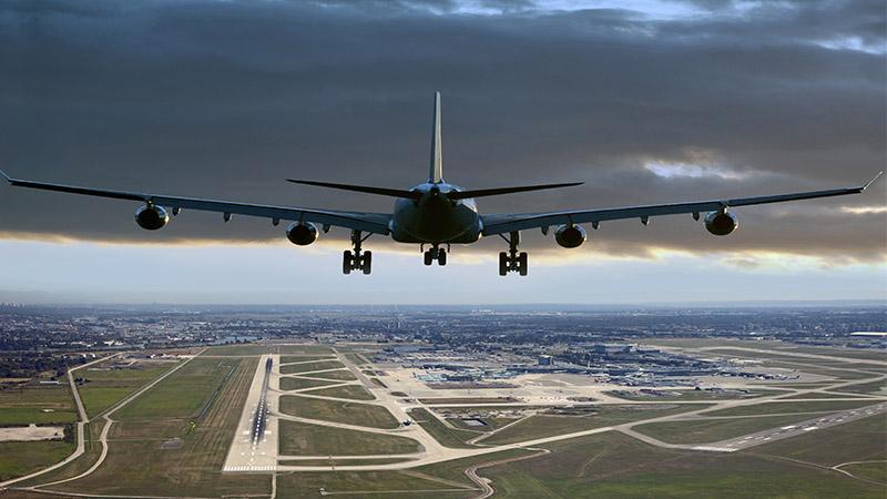

Summer is here, and it’s time for vacations and adventures! For many of us, this involves booking a flight to other destinations, with expectations for safe and efficient travel. However, we have probably all heard stories of — or even experienced — the dreaded disruptions of delayed or cancelled flights. One of the main reasons for this is that summer is also the season for thunderstorms, intense weather fronts, and sometimes windshear – which all bring risks and delays to air travel.
Just recently, a colleague described waiting for his flight from Budapest to Helsinki. The inbound flight from Helsinki was late with no explanation. When the plane finally arrived, incoming passengers walked through the gate, clearly shaken after a scary experience. My colleague asked a flight attendant what had shaken the passengers. The flight attendant explained that they had to go around a storm cloud that caused intense windshear. This led to a long delay as they were put in a holding pattern, followed by a very shaky landing with the passengers erupting into rapturous applause when the pilot safely landed the plane.
What’s micro weather got to do with it?
While we can’t change the weather, we can certainly improve our understanding of it and use state-of-the-art technology to reduce its impact on summer travel. This is what the team behind the Micro Weather Service for Aviation (MWS-A) project has been working on over the past three years.
MWS-A is a new support tool for air traffic control operations that provides advance warnings of severe weather to help pilots navigate safely and efficiently. MWS-A identifies "micro weather" (i.e., localized, microscale weather such as storm cells, windshear and turbulence) and predicts their movement using real-time observations from Vaisala’s remote sensing and lightning detection technology including:
- C-band weather radar
- X-band weather radar
- WindCube® Scan wind lidar
- Global Lightning Detection Network GLD360
It also incorporates the position and dynamic data of aircraft in the controlled airspace and applies algorithmic data processing to the combined data to generate information about predicted encounters of severe weather phenomena up to 40 minutes in the future.
Team Finland’s approach
The solution has been developed by a consortium of three Finnish organizations: Isaware, Fintraffic Air Navigation Services and Vaisala. Supported by European Space Agency’s ARTES 4.0, MWS-A is funded by Finland’s national contribution to the program and coordinated by Business Finland.

Acceptance Tests of MWS-A demonstration were conducted successfully at Helsinki-Vantaa airport on 24 and 25 January 2023. Tests have been attended by ESA representatives as well as future solution users (Helsinki Airport Air Traffic Control representatives).
MWS-A in action
In a recent article in Avionics International, Aleksis Kajava, Sales Director for Europe and Latin America and Vaisala’s Head of Aviation Strategy discussed the importance of situational awareness in the Terminal Maneuvering Area, and how Vaisala remote sensing technology plays a crucial part in safe and efficient takeoffs and landings in this area. But how do these sensors work in practice?
Helsinki-Vantaa Airport piloted MWS-A during spring 2023. Here is a real-life example of how air traffic controllers used MWS-A to improve safety and efficiency in the Terminal Maneuvering Area:
- A flight was approaching Helsinki-Vantaa airport from Central Europe.
- Vaisala weather radar detected increased echo signals, and analysis algorithms identified a moving thundercloud in Southwest Finland. Vaisala lightning data further classified this as an active thunderstorm.
- MWS-A computed flight route scenarios and detected that the airplane would overlap with the thunderstorm in 30 minutes.
- The service produced an alert of the encounter and displayed alternative flight routes.
- Air traffic controllers alerted the pilots and provided a new route around the weather system.

MWS-A is beneficial for all airports. Medium-size and large airports will gain significant benefit from safer and more efficient air traffic flow and capacity management. Smaller airports may also focus on safe and predictable operations for all kinds of airspace users, including U-Space.
A strong start with a promising future
It has been a privilege to be a part of this project to demonstrate Finland’s ingenuity in this area. While this trial period of the technical concept is now over, the results and feedback have been very encouraging. It is the hope of the project team that the concept will be taken into full time use at Helsinki-Vantaa and Tampere-Pirkkala Airports in Finland and that it could also serve as a proof of concept for the system to be used at other airports to improve safety and efficiency, and most importantly avoid unnecessary delays so that everyone can enjoy fun and stress-free summer holidays!

Vaisala Remote Sensing technology deployed in the Terminal Maneuvering Area provides crucial weather observation input data for MWS-A.