Expert article
8 ways IRIS Focus 8 transforms remote sensing data into weather intelligence
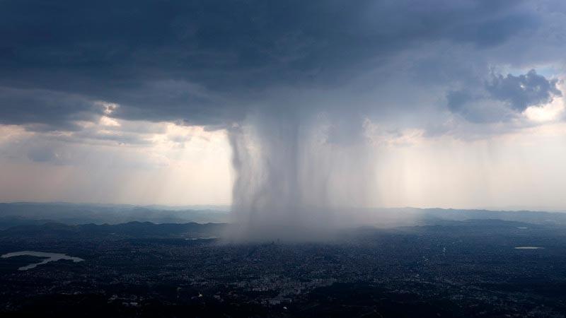



Climate change brings more frequent and intense extreme weather. To protect communities and infrastructure, meteorologists need more than data. They need comprehensive weather intelligence that combines radar networks, lightning detection, and surface precipitation measurements with powerful tools to improve weather forecasts.
Vaisala IRIS Focus transforms weather radar networks and sensors into tailored, real-time intelligence for meteorologists, forecasters, and operational users. For years, IRIS Focus has offered a highly interactive web interface for displaying and sharing remote sensing data at high resolution.
IRIS Focus 8 marks a major evolution. The platform now serves as the single, central software for visualizing, analyzing, and generating weather radar products. Built on modern architecture, it scales with your needs, adapts to new sensors and algorithms, and helps you extract maximum value from remote sensors.
Here are eight reasons to join the revolution in radar application software.
1. Complete precipitation insights for better forecasts
Forecasters at national meteorological and hydrological services want to see everything they know about a rain event in one place. Until now, radar observations and surface precipitation measurements appeared in separate tools. IRIS Focus 8 closes this gap. Radar products and surface precipitation observations now appear on the same map in the same interactive web interface.
Weather radar provides wide coverage and reveals the structure of precipitation aloft. Surface sensors deliver ground truth. Forecasters can now compare both in real time to spot rainfall sooner and issue warnings with confidence.
2. More accurate precipitation products, fully integrated in IRIS Focus 8
Reliable rainfall estimates form the foundation of precipitation forecasts and flood warnings. Yet radar-based estimation faces two challenges. First, the relationship between radar moments and rainfall rate depends heavily on precipitation type. Second, the radar beam may sample rain a kilometer or more above the ground.
IRIS Focus 8 addresses both challenges with a comprehensive set of new precipitation products. It integrates a wide range of configurable quantitative precipitation estimation (QPE) relationships. These range from the classic Marshall-Palmer Z-R to dual-polarization estimators and snowfall rate. You can select the relationship that best matches your climate and precipitation type.
New Surface Projected Reflectivity (SPZ) and Surface Projected Rainfall (SPR) products compute the vertical profile of reflectivity using high-resolution topography. When available, these products use two-dimensional melting layer data to project radar measurements down to the surface.
Rain accumulation also improves. An advection correction removes the gaps and fishbone artifacts that fast-moving storms create. A rain gauge correction anchors radar retrievals to ground truth.
3. More algorithms, faster, with a flexible framework
Radar experts and researchers invent many new algorithms and often publish them in open-source libraries such as Py-ART and Py-STEPS. In the past, integrating new algorithms into operational software took years as these systems need to be implemented with a strict software development process, high-quality assurance, and strict cybersecurity requirements.
Release 8 closes this gap with a new algorithm framework that serves as the backbone of the IRIS Focus product generation engine.
New data interfaces give algorithms access to the radar database while remaining language-agnostic. The framework supports C++ and Python, among other languages. Each algorithm runs as its own service, which protects the reliability of the whole system.
Once integrated, a custom or open-source algorithm behaves like a native product. It gets the same configuration interface, map display, events, alerts, and workflows. The framework already powers all native products in Release 8, including the new precipitation products.
IRIS Focus 8 builds a practical bridge between research and operations, bringing you more algorithms faster.
4. One central software platform for all operations
Vaisala customers have used IRIS Analysis for product generation and IRIS Focus for web-based visualization and analysis. With release 8, IRIS Focus becomes the main central-site software and generates radar products itself. IRIS Analysis may no longer be needed.
The transition starts with basic and precipitation products. For organizations operating radar networks, this means fewer systems to manage, less training, and simpler workflows, while keeping the intuitive IRIS Focus interface that end users have widely adopted.
5. Streamlined and customizable product generation for real-time and past data
In past releases, IRIS Focus generated on-demand products while IRIS RDA generated pre-generated products. Release 8 adds preconfigured products that generate continuously from a predefined configuration directly in IRIS Focus thanks to the web user interface.
You can organize products into groups for easier monitoring and activation. The system adapts easily when you add radars and products. The preconfigured products work for both real-time and past data.
Whether you monitor a developing storm or reanalyze last season's flood, you use the same algorithms, configuration, and tools.
6. Powerful data management and fusion
Release 8 introduces a new database that stores real-time and past data in one place. Data becomes immediately available for visualization, analysis, and reprocessing. A data management console lets you monitor incoming data and generated products. You can flag weather events of interest for later analysis, verification, or training.
The platform imports and exports data to standard formats such as ODIM HDF5 and NetCDF (CfRadial), among many others. It also integrates scanning wind lidars, lightning data, terrain data, and surface precipitation networks. This includes rain gauges and the new PRECICAP® Radar Precipitation Sensor RM60. IRIS Focus serves as a true platform for data fusion and display.
7. Modern, scalable architecture built for the future
Release 8 represents a deep modernization of IRIS Focus. We moved from a monolithic design to a scalable architecture of containerized services built around the algorithm framework and a new database.
We designed the platform for performance, reliability, and high availability. It scales with your network as you add radars, products, or users. Map services rely on geographical information standards, making it easy to add custom layers or external data such as satellite imagery.
You can install release 8 on hardware servers, virtual machines, or deploy it in the cloud as a single application instance.
8. Sustainable and secure operations throughout the lifecycle
Weather radar networks represent long-term investments. Throughout that lifecycle, operators need software that is maintainable, reliable, scalable, and upgradable. Cybersecurity has also become a critical concern. Regulations such as the EU Cyber Resilience Act enter into force at the end of 2027. Operational software will need more frequent updates to remain compliant.
Release 8 makes maintenance and upgrades of the central site smoother and easier by consolidating the central-site software and modernizing its architecture.
We built security into the design from the start. Development follows Vaisala information security management and secure development practices aligned with the EU NIS2 Directive and the IEC 62443 industry cybersecurity standard. Vaisala is also certified under ISO 27001.
Complete precipitation intelligence saves lives
Flooding causes devastating loss of life and property damage worldwide. Protecting communities requires understanding precipitation in complete detail: where rain falls, how intense it is, how much has accumulated, and what comes next.
IRIS Focus 8 delivers complete precipitation insights through a unified, modern, and flexible platform. For organizations working to stay ahead of extreme weather, this represents more than an upgrade. It gives you the intelligence systems needed to protect communities and save lives.

Ludovic Thobois is a Product Manager for IRIS Focus and TLP software at Vaisala, working at the intersection of weather radar, wind lidar, lightning sensing, and operational meteorology software. He focuses on translating advanced remote-sensing technologies into scalable, user-oriented solutions for customers in meteorology, aviation, and other weather-critical industries. His work spans remote sensor data and signal-processing concepts, multi-sensor integration, and the evolution of web-based applications that turn observations into actionable decision support.