The use cases for dual scanning lidar: answers to your questions
With the recent WindCube® Scan Dual Lidar Ready announcement and associated webinar, we have received many questions from wind energy players and research institutions. Some were interested in bankability and acceptance of dual scanning lidar in the industry, others in more operation and application-related topics. Hence, today’s blog focuses on the questions related to dual scanning lidar technology, operational considerations and global acceptance and track record.
Applications of the scanning lidar technology
You show examples of onshore deployments with scanning lidar. Can we place the lidar on transition pieces of the offshore turbines instead?
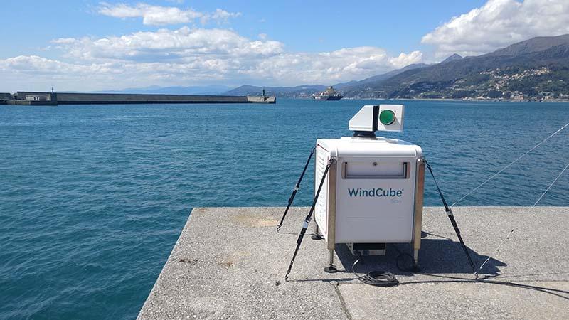
WindCube Scan Dual Lidar Ready is essentially a combination of two scanning lidars conveniently positioned to measure the wind parameters up to 10 and in some conditions up to 15 km. The dual lidar set-up is applicable onshore (during the webinar, Fraunhofer’s Florian Jager talked about their experience with dual scanning lidar for onshore applications), nearshore, and offshore. In fact, some of our clients have experience deploying scanning lidar on the transition pieces of turbines for Power Performance Testing (PPT) of several turbines at the same time or to carry out research studies such as wake studies or blockage effect. The dual lidar approach is also possible for such applications, deploying scanning lidar on multiple transition pieces of the turbines. Vaisala usually recommends having the system installed on a 3mx3m platform and to not obstruct the doors.
What is the range of the scanning lidar and up to what range is the availability good enough for evaluation (>80%) in your experience?
As defined in ISO 28902-2:2017, the maximum operational range is the distance to which a confident wind speed can be derived from the lidar signal. It depends on various parameters such as the accumulation time, physical range resolution, visibility, type of aerosols, and variations of refractive index in the atmosphere. The maximum operational range at 80% of availability is called R80 in the ISO 28902-2:2017.
There are three WindCube Scan models with different typical maximum operational ranges:
- WindCube Scan 100S – up to 3km
- WindCube Scan 200S – up to 6km
- WindCube Scan 400S – typically up to 10km and in certain conditions up to 15km
Is it possible to evaluate the spacing of a wind farm and suggest spacing improvements for future installations with scanning lidar?
Scanning lidar is known for wake study measurements for the purpose of wind farm layout optimization. Here is an example of the measurement campaign of Norwegian Center for Offshore Wind Energy (NORCOWE) on the Boundary Layer Stability Study.
For this campaign, two scanning lidars were used to run combined Plan Position Indicator (PPI) and Range Height Indicator (RHI) scans and to provide data on:
- High Resolution Spatial and Vertical uncertainty variability at the same time within a wake of multiple turbines
- Derive turbulence parameters (dissipation rate, etc.) from the PPI scans and use them to correlate to the length & width of the wake from RHI scans
The Smarteole collaborative project performed from 2014 to 2018 is another use case example, where measurement of turbines’ wakes was addressed with a scanning lidar.
When we perform a pre-construction WRA for an offshore wind farm using the dual scanning lidar setup, it should be difficult to do a hard target calibration due to absence of any hard obstacles offshore. In this context, do you think a hard target calibration by a drone is useful?
Offshore WRA campaigns are often performed using scanning lidar to achieve better horizontal and vertical coverage. In offshore environments with no nearby hard obstacle available, calibration by drone is indeed possible. However, based on our tests, the drone will have to be sufficiently large to get a reliable hard target back scatter signal. Thus, we recommend using a drone with dimensions similar to a DJI MATRICE 600 PRO.
Operation of the dual scanning lidar
Can you comment on how you intersect the line of sight (LOS) of two far beams? How does the probe length evolve with distance and how you reach enough accuracy in the sensor’s positioning for large ranges?
To ensure correct LOS intersection and reach enough accuracy for large ranges with dual scanning lidar setup, we recommend calculating the required azimuth and elevation angles for each LOS based on the target location and the two lidars’ coordinates. You will also need to configure these angles in the lidar Windforge software and ensure the accurate pointing of the two lidars toward the target. For the latter, we perform a hard target calibration on site to minimize the beams’ alignment uncertainty and hence improve the pointing accuracy. Thanks to the pulsed lidar technology, the probe length is constant with distance.
How much area would be required for complete dual lidar set up including power supply system (PV panels & battery system)?
To ensure correct and safe environment for the dual lidar set up, the WindCube Scan footprint should be taken into consideration. One lidar’s footprint is approximately 1.05x0.85m and one-meter free space around the system is recommended for ease of operation and maintenance, so the minimum recommended installation space is 3.05x2.85m for one lidar setup. WindCube Scan normally isn’t powered using PV panels and battery system because of the high-power consumption of the system (1.6kW). Therefore, we recommend to consider a suitable location to deliver power supply and safety for their particular deployments. The WindCube Scan flexibility allows finding multiple suitable locations to achieve the targeted measurement campaign.
How much and in what way do water droplets (fog & rain) and dust particles influence the quality of the measurements, and do you have a way of discriminating between these different types of aerosols?
Fog, rain, or dust particles will impact the radial wind measurement and the CNR signal shape; when very dense, they will block the laser signal and limit the range of the measurement. WindCube Scan can provide the relative backscatter data which could be used to identify zones of dense aerosol content (fog and dust particles). However, it is not directly possible to distinguish between the types of aerosols only with the WindCube Scan. A combination of suitable sensors (some can be provided by Vaisala) is possible to achieve this discrimination. How long does it take to process the data, i.e., do you give live results or are there some minutes, hours or days of processing time? Radial measurement data of scanning lidar is given in real time. A post-processing tool is used to reconstruct the dual lidar data, and it takes only a few hours to process several months of radial measurement data. Vaisala performs this post-processing in-house and adds a further quality control layer after the data processing is complete. It is recommended to process data regularly, for instance on a monthly basis.
How would you consider the time resolution in the calculation of the horizontal wind speed with two lidars when PPIs are used instead of fixed points?
Dual lidar post-processing reconstruction service is based on LOS intersecting scans and not on PPIs, to avoid the assumption made in the question.
Acceptance and track record
How many commercial campaigns for WRA (not counting R&D, global blockage) were carried using the dual lidar setup?
We are certainly not aware of all commercial WRA campaigns performed or ongoing with WindCube Scan Dual Lidar ready solution, but, for a couple of years now, we do see a growing request for lidars to be used in offshore-from-the-shore WRA campaigns thanks to the current trend of nearshore wind development in certain parts of the world, for instance in Asia.
Are the dual scanning lidar measurements currently accepted by the banks and investors?
We see growing acceptance in Asia, and more procedures are being matured, for instance by DNV or in Japan, to achieve traceability of measurements and calculation of measurement uncertainties.
For more information on the dual lidar setup and possible application and campaign considerations, contact Vaisala.