How scanning lidar detects a previously undetectable danger in China: dry windshear
At many airports, windshear – a sudden change of wind velocity and/or direction – is just as common in dry conditions as it is during thunderstorms but it is much less well understood and harder to detect. This is the case at Lanzhou Zhongchuan International Airport in China, where dry-windshear hazards are difficult to mitigate as no dedicated ground-based equipment for detecting such dry windshear is installed.
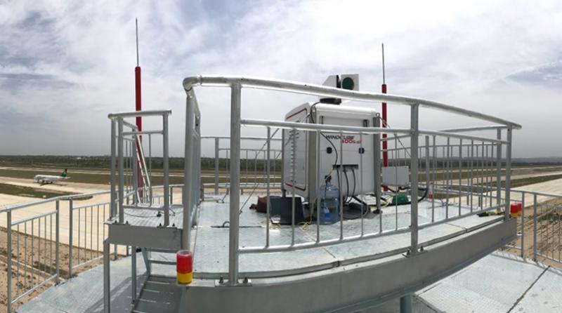
Located in the northwest region of China, surrounded by 2,000-meter-high mountains, Lanzhou airport faces frequent and dangerous windshear events in the spring and summer seasons. At least 15 events are reported every year by pilots, with most of these occurring below an altitude of 500 meters and in dry air conditions. In 2015, the Air Traffic Management Bureau (ATMB) decided to launch a feasibility study to detect local windshear using WindCube® Scan, scanning doppler wind lidar, capable of providing dry windshear alerts and warnings for each departure and arrival corridor. By deploying a WindCube 400S unit at Lanzhou Zhongchuan, they hoped to be able to detect local windshear with wind lidars and identify a better way to manage this weather risk.
Into the unknown
When the WindCube unit arrived, the windshear characteristics at Lanzhou Zhongchuan were largely unknown. This meant that officials would be adapting their processes and methodologies, using the lidar to build a more detailed, quantified picture of the local weather patterns and windshear sources.
Installed close to the center of the runway, the WindCube lidar was configured to get optimal data resolutions and refresh rates to meet the requirements of the observers, forecasters, and pilots. A methodology was also developed with the different stakeholders at the airport in order to quantitatively validate the windshear data provided by the WindCube lidar, based on reports provided by pilots.
The lidar’s uptime during the initial study was 99.6%, and it provided accurate windshear data 97% of the time. However, based on the methodology defined and after analyzing the different windshear events with local meteorologists, it was determined that the lidar’s detection ratio for dry windshear events was in fact, 100%.
New understandings
Over the course of the study, the WindCube lidar successfully characterized the dry windshear characteristics for the airport area – something that had never been possible before. The lidar’s implementation has provided not only automatic and accurate windshear alerts, but a broader understanding of the airport itself and how to proactively keep it safe and running efficiently.
For more, see “Lidar Solutions”, co-authored by Dr Ludovic Thobois of Leosphere, a Vaisala company, in Meteorological Technology International.
You can also view our recent webinar – now available to watch on-demand – in which Dr Thobois and Timo Lindfors of Vaisala, discuss the challenges of windshear.

