More is the norm: What’s in store for the Atlantic hurricane season
Check out what’s in store for the Atlantic hurricane season and how dropsondes help hurricane hunters
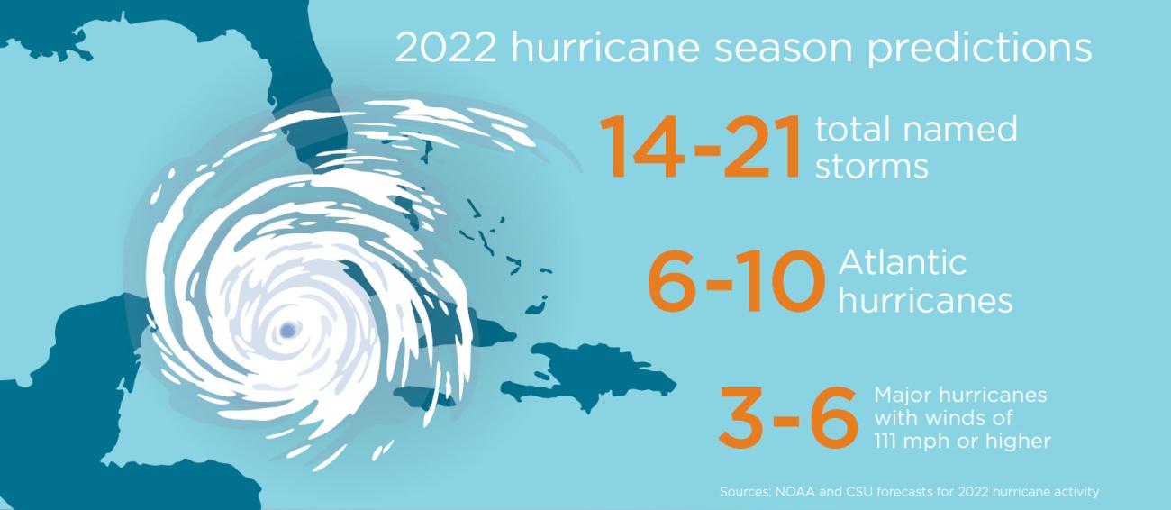
Tropical storm Ana formed on May 20, 2021 – another early start to an above-normal active hurricane season. Predictions for the 2022 hurricane season indicate what is becoming clear: above normal is becoming normal.
Why dropsondes are essential to hurricane hunters
Satellites are vital and provide a tremendous amount of information for forecasters. But dropsondes go even further.
Dropsondes collect high resolution atmospheric data such as wind speed and direction, temperature and humidity. These devices help researchers in several ways: Their measurements help them understand the structure of the storm and determine how strong the winds are and how low the pressure is at the surface in the eye. This information is essential for improving the hurricane forecast, and the best way to get that data is to fly an aircraft through the center of a hurricane using a variety of radar systems to analyze the storm while releasing dropsondes.
Dropping measurements by the second
When a dropsonde is released by an aircraft, it sends data back to the aircraft continuously through its 2,000-3,000 feet-per-minute descent.
Hurricane professionals or hurricane hunter aircraft often use the Dropsonde NRD41 in their missions. Here's how much data the dropsonde transmits:
- Every half second: Transmits pressure, temperature, and humidity measurements
- Every quarter second: Transmits it 3D position using a GPS receiver (referred to as 4 Hz data)
- Every quarter second: The dropsonde also measures the wind from the GPS receiver, because as the dropsonde is embedded in the wind field as it descends by parachute
Dropped into the eye wall of a very intense hurricane, the dropsonde spirals around the center and will often splash to the opposite side of the eye as it follows the winds in the eye wall. The aircraft collects the data, then transmits it in real time via satellite to the National Hurricane Center. Computer models also receive the data, which researchers use to determine the structure of a storm and to forecast its intensity and trajectory.
Supporting another high season
The 2021 hurricane season was above average with 21 named storms and 7 hurricanes. The US Air Force and National Oceanic Atmospheric Administration (NOAA) deployed hurricane hunters who flew a combined 1,265 hours and completed 143 missions, dropping over 2,300 dropsondes. This essential data enables more accurate forecasts and earlier warnings, which saves lives and property; for example, when Hurricane Ida – the strongest of the season – hit the U.S. in August 2021.
Check out our infographic From sky to ground
to see 2021 hurricanes and dropsondes by the numbers, plus predictions for the 2022 season

Hurricanes in 2022 and beyond
With 14-21 named storms including 6-10 Atlantic hurricanes being predicted for 2022 (see the CSU 2022 forecast and the NOAA forecast), it isn’t a coincidence that this will likely be the seventh consecutive year with above-average hurricane activity. The North Atlantic Ocean is warming due to worldwide climate change. Even a couple of degrees makes a big difference when it comes to hurricanes: Warmer waters mean not only more evaporation, but also more potential energy to feed the storms.
It is becoming ever more important to continue developing and making full use of dropsondes. We can’t stop the storms from coming, but we can be better prepared and save lives.
* Dropsonde NRD41 is built by Vaisala under license from UCAR. The RD41 Dropsonde, aircraft data system hardware, and software used by hurricane hunters were developed by the Earth Observing Laboratory at the National Center for Atmospheric Research.
