Device Vaisala Weather Radars Get superior weather radar data quality and availability through industry-leading data processing...
event SAHA 2026 International Defence & Aerospace Exhibition May 5, 2026—May 9, 2026 Our experts will showcase defense meteorology solutions ranging from sounding systems and tactical...
event Airspace World 2026 May 26, 2026—May 28, 2026 Join Vaisala at Airspace World 2026 and visit us at booth H1-G48.
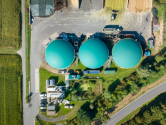
event Biogas Americas 2026 May 18, 2026—May 21, 2026 Vaisala is excited to exhibit at BIOGAS AMERICAS 2026, the American Biogas Council’s must attend...
release Vaisala Corporation: Managers’ Transactions – Hänninen, Samuli Mar 6, 2026 Vaisala Corporation Managers’ Transactions March 6, 2026, at 2:00 p.m. (EET) Vaisala Corporation...
release Vaisala Corporation: Managers’ Transactions – Gulli, Lorenzo Mar 6, 2026 Vaisala Corporation Managers’ Transactions March 6, 2026, at 2:00 p.m. (EET) Vaisala Corporation...
release Vaisala Corporation: Managers’ Transactions – Pylvänäinen, Vesa Mar 6, 2026 Vaisala Corporation Managers’ Transactions March 6, 2026, at 2:00 p.m. (EET) Vaisala Corporation...
general page グローブボックスとアイソレータのモニタリング Oct 7, 2024 グローブボックス、アイソレータ、トランスファハッチ、そしてアクセス制限バリアシステムは、湿気やさまざまな気体の濃度に敏感な素材を加工する際によく使用されます。