
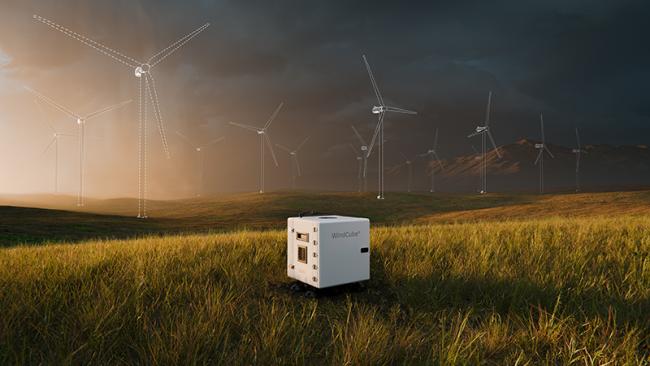
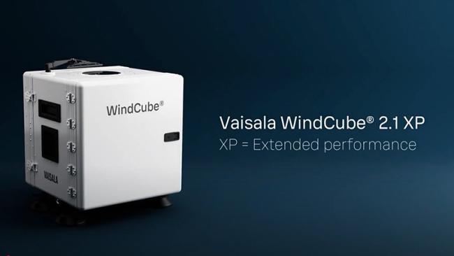
WindCube® 2.1 XP

Bankable wind data beyond your met mast measurements
Complement your met mast measurements or use WindCube as a stand-alone solution for accurate and bankable wind data.
- Capture wind data from the full rotor sweep height with measurements that reach up to 400m
- Faster deployment and lower costs with no permitting
- Get data simultaneously from 20 heights for full wind profile
- Easily relocate your WindCubes to capture spatial variations of your site
Accuracy where it matters most
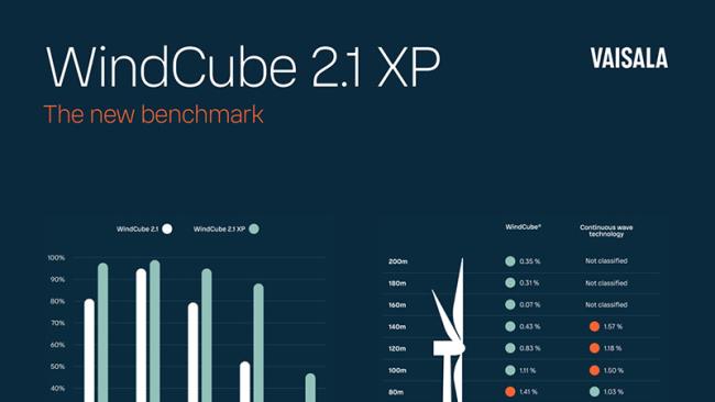
Critical measurement heights for large and utility scale wind projects range between 60m to 270m (rotor sweep height). WindCube uses pulsing technology with a constant probe volume and a patented wind reconstruction algorithm to achieve exceptionally low measurement uncertainties at the heights that matter most for your wind resource assessment (WRA).

Features behind WindCube 2.1 XP accuracy
Constant probe volume
Unlike continuous wave lidars, WindCube uses constant probe volume which means all 20 heights can be measured simultaneously without compromising accuracy or data availability.
Unique wind reconstruction algorithm
IEC classified and patented hybrid wind reconstruction algorithm lets you blend scalar and linear methods to reduce sensitivity to turbulence.
Vertical wind measurement
WindCube’s unique capability to measure vertical wind allows better performance in conditions with wind variations. The embedded Flow Complexity Recognition (FCR) algorithm enables reliable wind data even in moderately complex terrain.
Trusted and validated by the wind energy industry

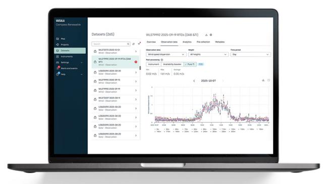
WindCube Pure TI™
WindCube Pure TI™ is a physics‑based turbulence intensity (TI) reconstruction in Compass Renewable that uses high‑frequency WindCube data to calculate TI more accurately and consistently across measurement heights.
By correcting lidar‑specific biases and inter‑beam averaging effects, Pure TI delivers TI values that better reflect real site conditions and are aligned with modern turbine design and site‑suitability expectations.
- Improve turbine selection, site suitability assessment and load assessment with trusted TI measurements at hub and tip heights, directly from WindCube campaigns.
- Reduce dependence on dedicated TI met-masts and simplify permitting, construction, and site access.
- Lower TI‑related uncertainty with a reconstruction method validated across dozens of WindCubes at multiple sites and benchmarked against IEC and DNV guidelines.

Exceptional data availability even in clean air conditions
Low aerosol environments can be difficult for wind lidars causing reduced data availability.
Increased laser power output and fine-tuned detector sensitivity in WindCube significantly improves the data availability in low aerosol environments making it suitable for use in areas with clean air.
Boost your data availability even further with the new post-processing algorithm featured in Compass software.

Capable in complex terrain
WindCube is the only wind lidar you can use in moderately complex terrain without having to post process the data. This is possible by measuring vertical wind speed with a dedicated beam in combination with the proven Flow Complexity Recognition (FCR) algorithm.
For truly complex terrain, you can use Computational Fluid Dynamics (CFD) correction methods and input correction factors to your dataset in Compass software.

Simple fleet management, data hosting and post-processing
Get the most out of your WindCubes with Compass software
- Access historical wind data for initial site selection
- Manage, configure and monitor your WindCubes remotely
- Collect and store bankable wind data
- Complex terrain estimator tool helps you to choose the right reconstruction method
- Improve data availability with the booster algorithm
- Evaluate weather data for wind resource assessment
WindCube goes anywhere
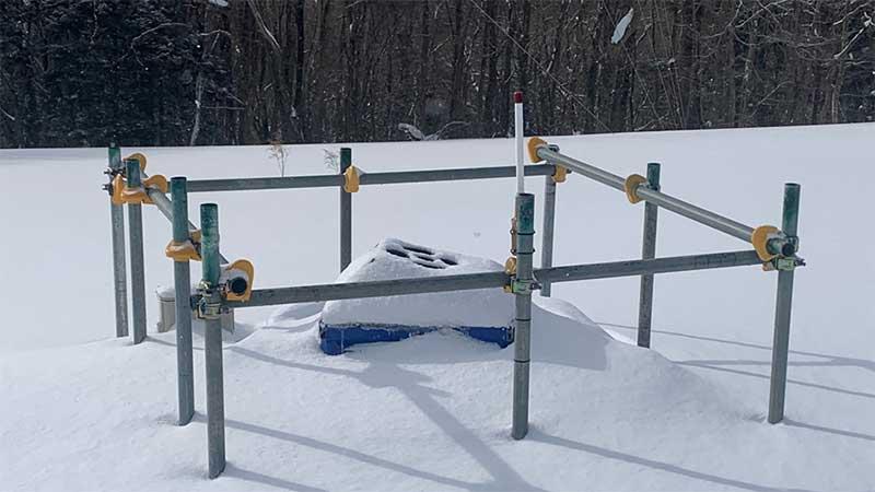
Cold conditions
Winter kit for reliable operations in cold and snowy conditions
Image courtesy of JWD

Hard to access locations
Small size and weight combined with low power requirements allow installations to even difficult locations
Image courtesy of ISAE-SUPAERO
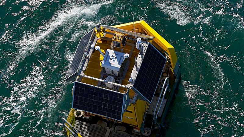
Offshore
WindCube Offshore Edition is trusted by the leading offshore developers around the world
Image courtesy of Akrocean

Suitable for remote locations
Low nominal power consumption of only 35W frees WindCube to operate with smaller powering solution than other wind lidars.

Everything you need to get started quickly
- Installation services
- Online and on-site training
- Power packs for remote power supply
- 3G/4G router or satellite connectivity for remote locations •Winter kit for heavy snow and cold conditions
- PTH sensor with rain measurement (WXT535)
- Pre-certified WindCube units for accelerated deployment Compass cloud software for remote management and data hosting

Unmatched service network
Ensure maximum uptime and reliability of your lidars without having to ship the units off-site.
- Industry’s best 5-year warranty
- Global on-site maintenance and repair services
- 7 local service centers
- Lidar verification services with 3rd party certification bodies
“With its performance enhancements, the WindCube 2.1 XP offers a highly effective solution for use of wind lidar in combination with measurement masts in complex terrain. This makes it an invaluable tool for accelerating the development of wind energy projects, reduces risk and improves site knowledge, especially in remote or complex locations.”
Florian Lachinger, MSc
Senior Consultant Wind Measurement
Energiewerkstatt Verein
”Not only does this strategy result in safer, bankable measurement campaign, a 12-month standalone lidar measurement campaign is also faster (no planning or premissions delays) and cheaper (37% savings) than a traditional met mast measurement campaign.”
Iain Campbell
Senior Technical Analyst and Wind Resource Manager, RES
Resources
Discover WindCube 2.1 XP: The new benchmark in wind lidar
Attend this webinar to hear more about the new evolution of WindCube.

Get started with WindCube 2.1 XP today
Contact Vaisala to learn how to put the industry's most accurate wind measurement to work for your needs.